
Ein Keshatot
"I see in the ruins of Umm el-Kanatir the best of the discoveries that I have made..."

So wrote the polymath Scottish, South African-born, British Member of Parliament, author, traveller, diplomat, British intelligence agent, Christian Zionist and mystic, Laurence Oliphant who, together with the American-born civil engineer, architect and archaeologist, Gottlieb Schumacher—an important figure in the early archaeological exploration of Palestine about whom I have written here—first documented the existence of the ancient synagogue at Ein Keshatot in the Golan Heights in 1884. The site known at the time only by its Arabic name of Umm el-Kanatir (ام القناطر)—meaning ‘mother of the arches’—now also has the Hebrew name of Ein Keshatot (עין קשתות)—pronounced ‘K’shatot’ meaning ‘spring of the arches’. I visited with my two (adult) children on Shushan Purim, in March 2023.
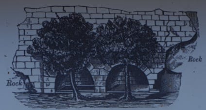
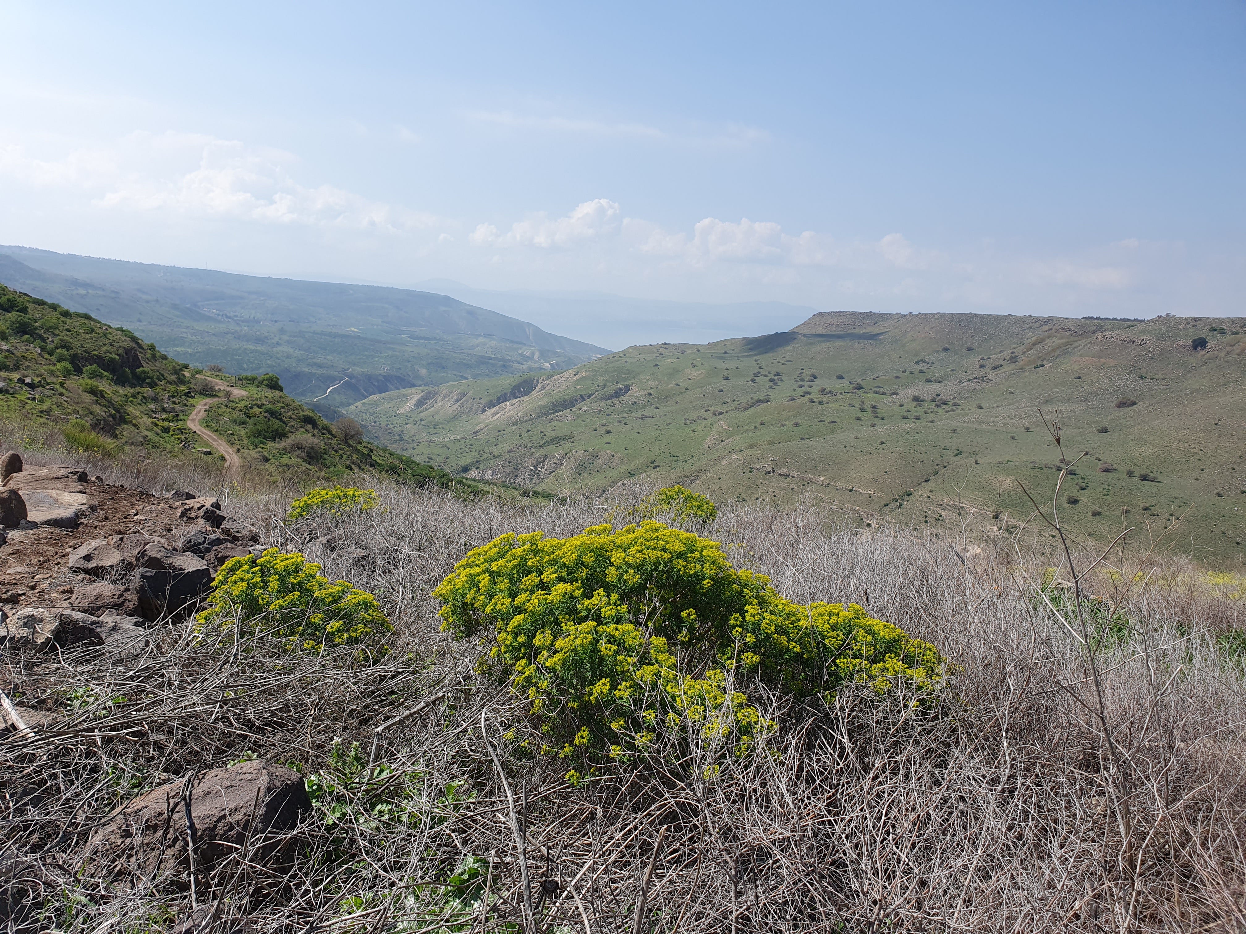
At the site, which is about eight kilometres due east of Lake Kinneret, above the Samekh river-bed, a natural spring flows from the cliff into three basins that were once topped by monumental basalt arches, one of which survived from antiquity. Amid ruined walls and large blocks of stone, Oliphant discovered typical elements of a synagogue dating to the 5th to 8th centuries CE: a stone carving of a vulture, a fragment of a cornice, a large triangular slab that he believed was placed on the lintel of the main entrance of the synagogue, and fragments of Corinthian capitals. The vulture—which is a well-known motif in Jewish art in the Golan and Galilee at that period—is visible on a double column and on the front gable of the synagogue.


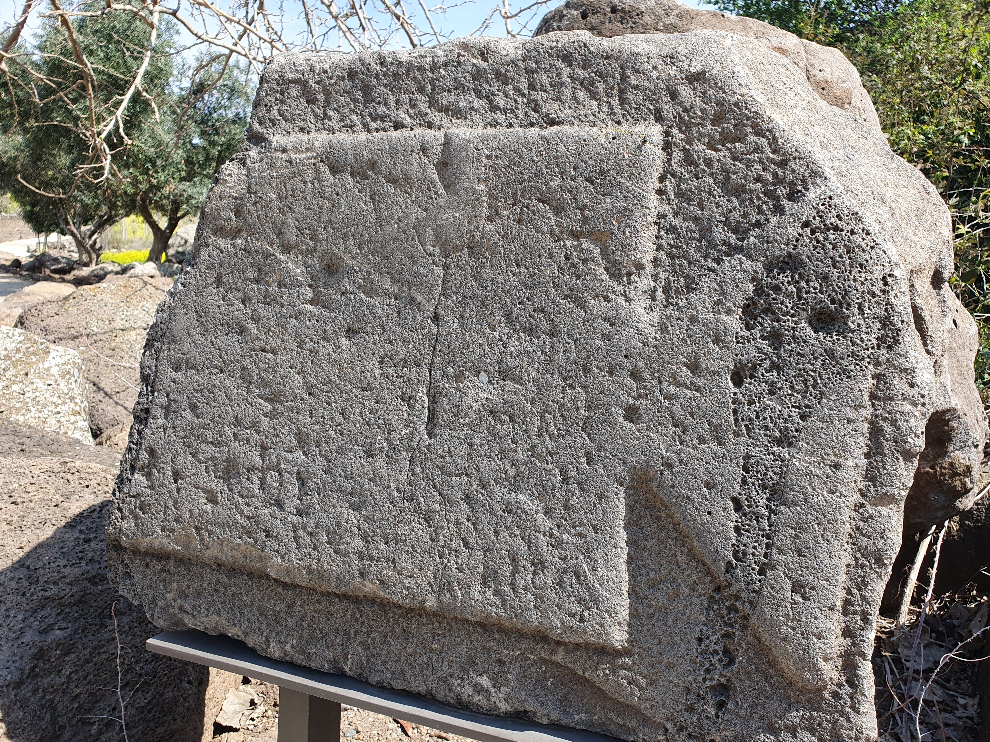
In 1903, Heinrich Kohl—the German architectural historian and archaeologist—and Carl Watzinger—the German archaeologist—excavated inside the synagogue, as part of their investigation of synagogue ruins in the Galilee. Eleazar Lipa Sukenik—the Israeli archaeologist and professor who helped establish the Department of Archaeology at the Hebrew University in Jerusalem—visited the site in 1928 and described a stone, which subsequently disappeared, bearing an inscription set in a tabula ansata located next to the spring; the inscription was unclear, but the letters appeared to be Greek. The stone was rediscovered in 1970 by the Golan Survey Team, but its location again lost. In the second decade of the 21st century, a photograph of the stone was found among the papers of the estate of Dan Urman, the Israeli archaeologist and historian, and the stone itself was yet again rediscovered during work on site by the Israel Antiquities Authority in 2017. It is now displayed on site.
Although the ruins of the synagogue were well known once their rediscovery was published, excavations were not undertaken, because of the site’s remoteness and inaccessibility. Syrian shepherds continued to inhabit the ruins into the 1950s, reusing the carved masonry, and the Syrian census of 1960 listed a farm at the site with 90 inhabitants.
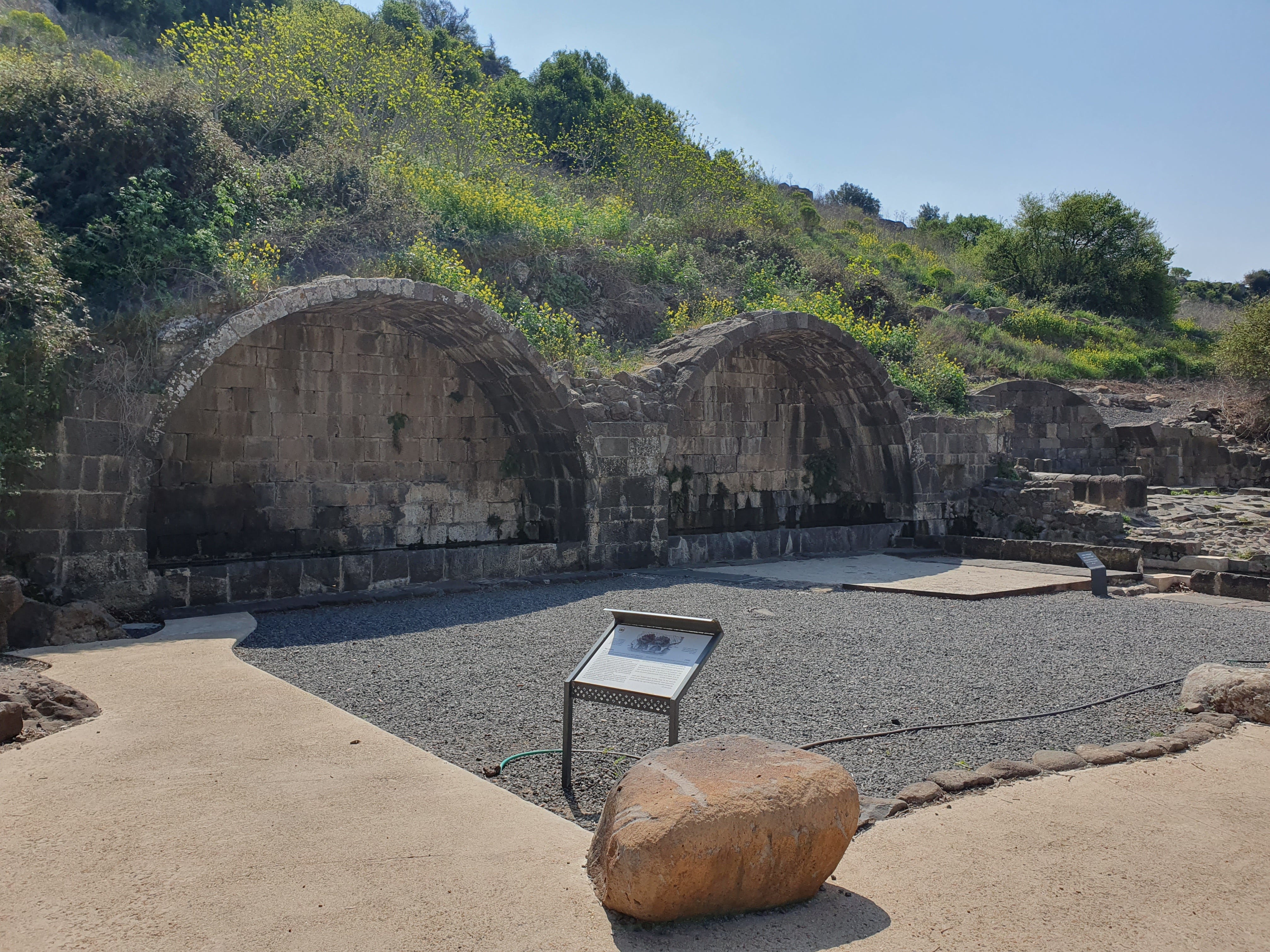


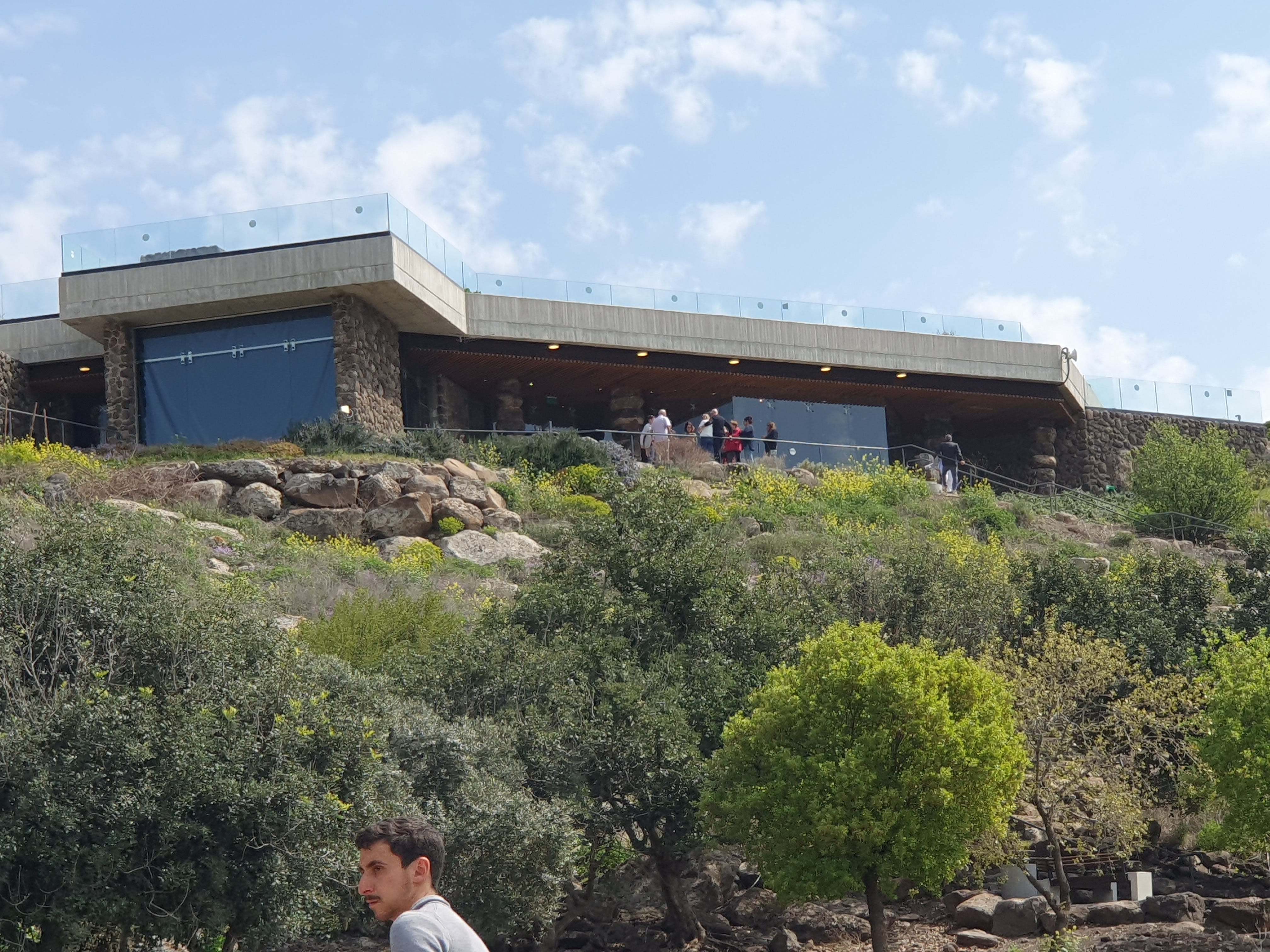
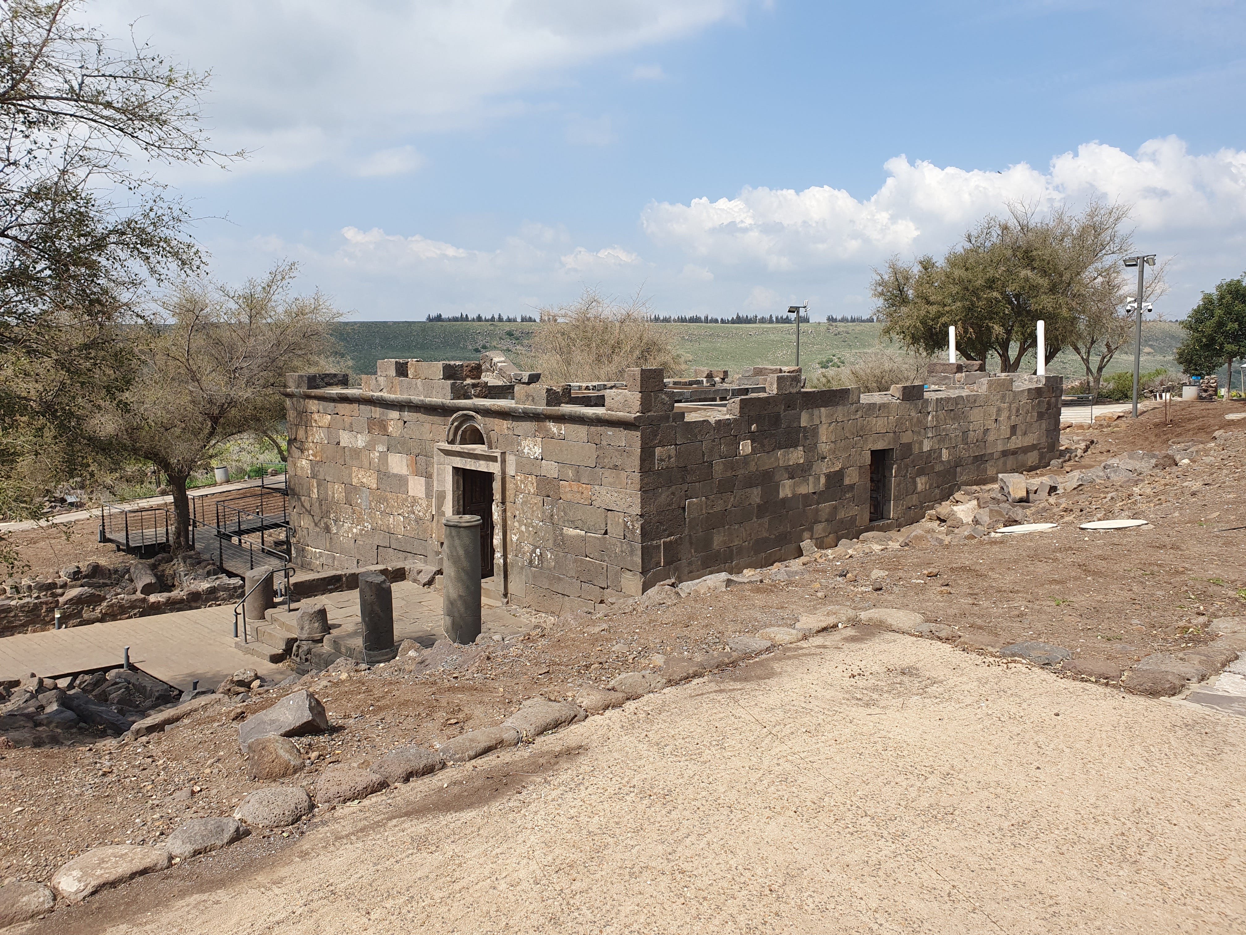
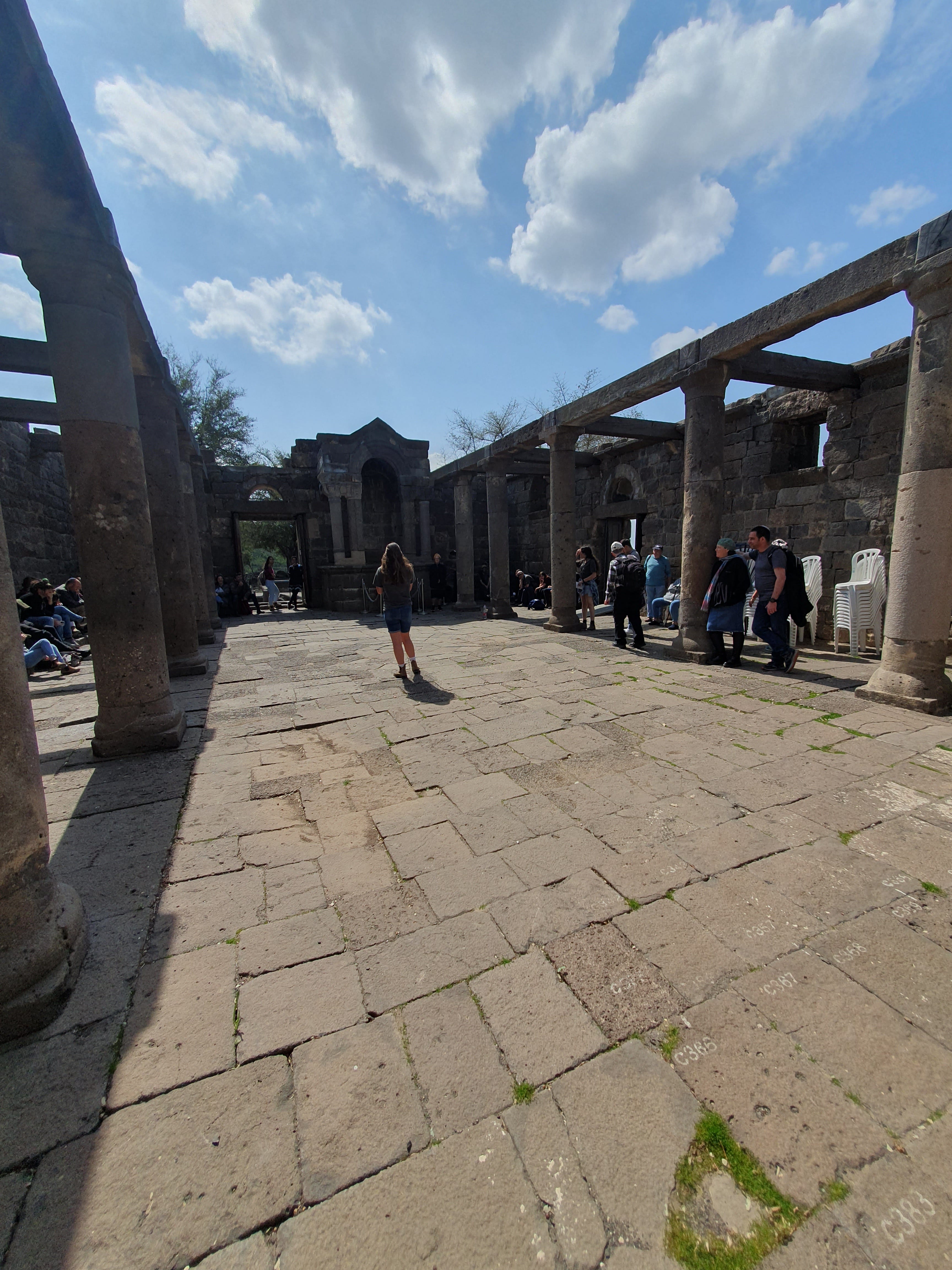
After Kibbutz Natur, now a moshav, was established only a kilometre north-east of the site in 1980, it became more accessible and, in 1995, a development and excavation project was begun at the site by the Golan Regional Council and educational institutions in the Golan. Excavations between 2000 and 2003 revealed a Roman-period settlement and synagogue. A project was inaugurated in 2003—under the auspices of Yehoshua Dray, Chaim Ben-David and Ilana Gonen of Kinneret Academic College and Bar-Ilan University—to reconstruct the synagogue using state-of-the-art high-tech computer technology to code and digitally record the stones. The blocks were then tagged with Radio-frequency identification chips, and a special crane lifted and inserted them in the correct sequence, enabling the anastylosis1 of the first storey of the synagogue with great accuracy. The excavation and subsequent reconstruction of the synagogue took 15 years to complete, and it is planned in time similarly to reconstruct the second storey. Two of the three arches over the spring have also been reconstructed, and the site is today recognised as a National Heritage Site. A bautiful visitor centre which shows a film about the site has been built above the site.
Photographs and drawings from the various surveys and excavations undertaken, dating back to Schumacher, can be seen here.
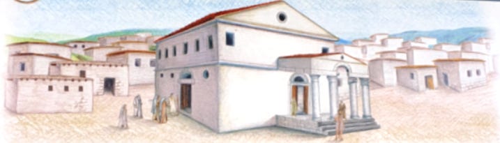
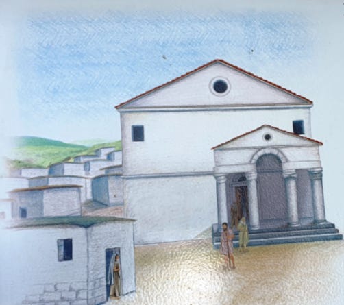
The site is believed to have been a pagan Roman town that venerated the nearby spring, with Jews beginning to settle in the vicinity in 23 BCE. The arches and pools around the spring date from the pagan Roman era, and their original purpose is unclear. Hypotheses include a luxurious spring house from the Byzantine period or an industrial complex that required large quantities of water, perhaps for bleaching linseed oil, or a spring building in a non-Jewish ritual context from the Roman period. In any event the earliest of the later Jewish inhabitants established a flax industry, using the water for washing and whitening the flax from which they wove fine cloth. The textiles were sold to wealthy residents in the nearby towns of Sussita and Bethsaida. Although no terracing has been found, it seems likely that the villagers engaged in olive cultivation, mixed farming, and raising sheep and goats. Two olive presses have been found at Ein Keshatot, which would have produced an excess to the village’s needs, which was no doubt exported east into the Bashan and Horan regions.
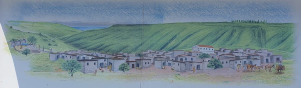


In the fifth century the town’s inhabitants built a large synagogue, which they embellished during the sixth century, clearly demonstrating the prosperity of the community. At this time, about 500 years after the destruction of the Temple in Jerusalem, the land was ruled by the Byzantine Christians. Though at times a hostile rule, Jews were on the whole allowed to live their lives as they wished. The centre of Jewish life was, at this time, in the Galilee, to which this Golan village was connected culturally and spiritually. There are about thirty ancient synagogues dating to this period which have been discovered in the Golan, and some 120 in all of Israel. Ein Keshatot’s very beautiful synagogue was 18 metres by 13 metres, rising to 12 metres in height—one of the largest of the ancient synagogues discovered in the area.
They synagogue was decorated with Temple motifs including a menora (Temple candelabra), a lulav (palm frond), an etrog (citron), an incense shovel, a grape vine, and eagles or vultures, as well as geometric designs.
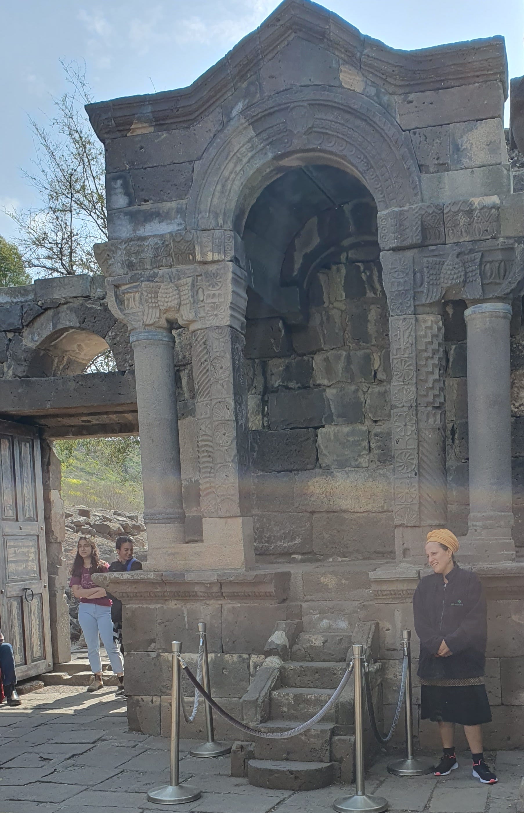


Although it is normal for the Ark to face south in the Golan (the direction of Jerusalem, to which all synagogue Arks point), that the main entrance was also in the south façade—necessitating its being offset—seems to have been a local Golan tradition.
The covered porch was supported by four pillars whose pedestals were incorporated into the steps. One of these pedestals incorporates a predatory scene of a lion devouring its prey, with a cockerel watching from one side. This piece of masonry was probably reused from an earlier structure, since it was covered over with plaster and built into the stairs, so that people would not have seen it.


The residents abandoned the town after it was destroyed by the catastrophic Galilee earthquake of 749, known in Jewish sources as the Ra’ash Shevi’t—which also destroyed Tiberias, Scythopolis (Beit She’an), Pella, Gadara, and Hippos (Sussita).
In the Levant we see that the ancient, often-Hebrew names of many places were frequently preserved by the local Arab inhabitants who heard the ancient names from their elders and continued using them. But for this to happen requires continuous habitation or usage. But from the time of the earthquake in the 8th century CE, until the 13th century, there were no real communities in the central Golan and, over this period of hundreds of years, the ancient names of many places were lost. In the 19th century, ancient Jewish villages in the Golan were given Arabic names by the local population who re-occupied the sites, since they did not know the old Hebrew names.
Thus the name Umm el-Kanatir is a relatively modern Arabic name for the site, and we do not know the village’s ancient name, but identification attempts based on Jewish sources have led to two possible ancient names: Qantir (קנטיר), mentioned by Rabbi Menachem di Luzano in the early seventeenth century in his book Ma’arikh, as “a locality on the other side of the Sea of Tiberias, still known by that name”; and Qamtra, the name of the town of the third century amora, Simeon Qamtria—that is, Simeon of Qamtra—mentioned in the Jerusalem Talmud (Berachot 9:2).
Since Rehavam Ze’evi (“Ghandi”), Israel’s Minister of Tourism in 2001, initiated the excavation project of the ancient synagogue, when he was murdered by terrorists in Jerusalem soon afterwards, the site was unofficially renamed Keshatot Rehavam (‘Rehavam’s arches’) as a way of commemorating him. However the Israel Government Names Committee instead chose Ein Keshatot, reflecting the unique stone arches that stand over the spring.
Anastylosis is an archaeological term for the reconstruction technique whereby a ruined building or monument is restored using the original architectural elements to the greatest degree possible, combined with modern materials if necessary, ensuring that the latter are unobtrusive yet clearly recognizable as replacement materials.